Comprehensive Automated Risk Assessment
This tool streamlines the public health emergency preparedness risk assessment process by automating the collection and analysis of publicly available data. It helps local and Tribal health agencies identify, prioritize, and mitigate the most significant risks affecting their communities.
Select Region or Jurisdiction
ArcGIS Data Export
Export CARA risk assessment data for all Wisconsin jurisdictions in ArcGIS-compatible formats.
CSV Export
Tabular data for spreadsheet analysis and GIS joining
Loading...
Generating exports...
Processing risk data for all Wisconsin jurisdictions
Processing risk data for all Wisconsin jurisdictions
Export comprehensive risk scores for all 95 Wisconsin jurisdictions for use in ArcGIS mapping and analysis
Exported Data Fields:
- total_risk_score - Overall composite risk
- natural_hazards_risk - Combined natural hazards
- health_risk - Public health vulnerability
- active_shooter_risk - Community violence risk
- extreme_heat_risk - Heat-related health risk
- air_quality_risk - Air pollution risk
- lat, lon - Geographic coordinates
- county, fips_code - Geographic identifiers
ArcGIS Usage:
- Open ArcGIS Pro → Add Data → Add XY Data
- Select CSV, set X=
lon, Y=lat - Coordinate System = WGS84
- Use risk fields for symbology
Wisconsin Public Health Regions
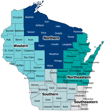
Wisconsin is divided into five public health regions: Northern, Northeastern, Western, Southern, and Southeastern.
Tribal Health Jurisdictions
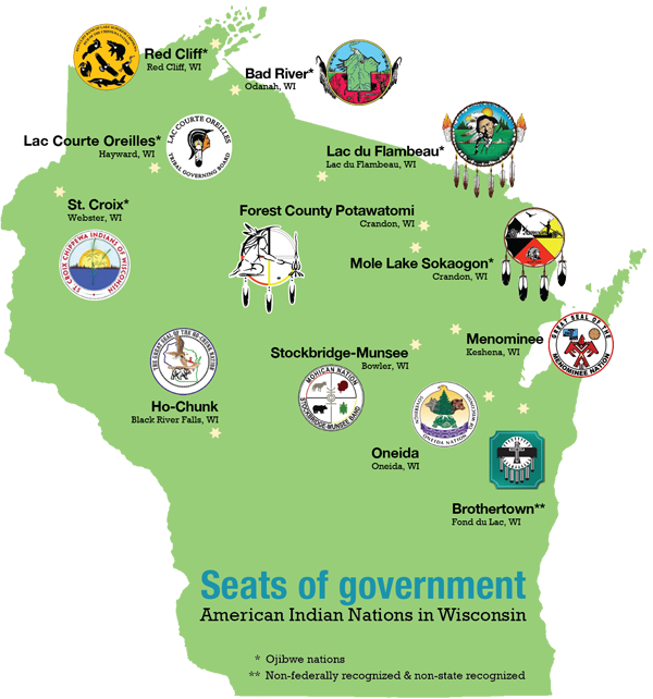
Wisconsin is home to 11 federally recognized tribal nations with public health jurisdictions.
Source: Wisconsin First Nations